This article was scraped from Rochester Subway. This is a blog about Rochester history and urbanism has not been published since 2017. The current owners are now publishing link spam which made me want to preserve this history.. The original article was published October 07, 2013 and can be found here.
![The fourth part of the Bike Rochester Series... let's hit the Genesee Greenway and Lehigh Valley Trails! [PHOTO: Ryan Green]](https://senseofplace.dev/content/images/photos/rgbike-rochester-genesee-valley-greenway-lehigh-valley-trail-LV101.jpg)
The following is a guest post submitted by Ryan Green .
Submit your story today .
The fourth part of the Bike Rochester Series differs quite a bit from the previous ones. We will be venturing on old railroad rights of way (train tracks converted to trails via Rails to Trails Programs). The biggest difference here is that these trails are not paved; they are packed dirt/grass and crushed stone (similar to parts of the unpaved canal trail). So a road bike is not recommended, however a hybrid bike will be more than comfortable and safe. This is the perfect ride to do during the Fall!
![- [PHOTO: Ryan Green]](https://senseofplace.dev/content/images/photos/rgbike-rochester-genesee-valley-greenway-lehigh-valley-trail-LV.jpg)
The route here samples a variety of trails: Genesee Riverway, Genesee Valley Greenway, Lehigh Valley, and Canal Trails. It includes a total of about 4.15 miles of riding on roads to connect to disjointed parts of the trails. The 40 mile loop will take us though scenic rural farmlands and forests, as well as a couple of nice small towns. [View this route in Google Earth using this .KMZ file ]
![- [PHOTO: Ryan Green]](https://senseofplace.dev/content/images/photos/rgbike-rochester-genesee-valley-greenway-lehigh-valley-trail-LV1.jpg)
Let's begin at the city's entrance to the west bank Genesee Riverway Trail, at Court Street. There is plenty of parking nearby. We glance at the Dinosaur BBQ, which was once the Lehigh Valley Railroad's Rochester station. We will experience much of the LVRR's historical footprint on our trip.
![- [PHOTO: Ryan Green]](https://senseofplace.dev/content/images/photos/rgbike-rochester-genesee-valley-greenway-lehigh-valley-trail-LV2.jpg)
![- [PHOTO: Ryan Green]](https://senseofplace.dev/content/images/photos/rgbike-rochester-genesee-valley-greenway-lehigh-valley-trail-LV3.jpg)
![- [PHOTO: Ryan Green]](https://senseofplace.dev/content/images/photos/rgbike-rochester-genesee-valley-greenway-lehigh-valley-trail-LV4.jpg)
![- [PHOTO: Ryan Green]](https://senseofplace.dev/content/images/photos/rgbike-rochester-genesee-valley-greenway-lehigh-valley-trail-LV5.jpg)
Images around Corn Hill Landing. There's more parking here, and our city is well mapped for visitors.
![- [PHOTO: Ryan Green]](https://senseofplace.dev/content/images/photos/rgbike-rochester-genesee-valley-greenway-lehigh-valley-trail-LV6.jpg)
![- [PHOTO: Ryan Green]](https://senseofplace.dev/content/images/photos/rgbike-rochester-genesee-valley-greenway-lehigh-valley-trail-LV7.jpg)
![- [PHOTO: Ryan Green]](https://senseofplace.dev/content/images/photos/rgbike-rochester-genesee-valley-greenway-lehigh-valley-trail-LV8.jpg)
![- [PHOTO: Ryan Green]](https://senseofplace.dev/content/images/photos/rgbike-rochester-genesee-valley-greenway-lehigh-valley-trail-LV9.jpg)
![- [PHOTO: Ryan Green]](https://senseofplace.dev/content/images/photos/rgbike-rochester-genesee-valley-greenway-lehigh-valley-trail-LV10.jpg)
Typical view of the west bank trail.
![- [PHOTO: Ryan Green]](https://senseofplace.dev/content/images/photos/rgbike-rochester-genesee-valley-greenway-lehigh-valley-trail-LV11.jpg)
We pass by the abandoned Flint Street warehouse with a relatively new mural painted upon it.
![- [PHOTO: Ryan Green]](https://senseofplace.dev/content/images/photos/rgbike-rochester-genesee-valley-greenway-lehigh-valley-trail-LV12.jpg)
At 1.5 miles (note: distances mentioned here are based on actual distances on my bike's odometer and may differ slightly from distances calculated on maps and elsewhere) we reach the Erie Lackawanna Bridge to the U of R, which we will be crossing on our way back.
![- [PHOTO: Ryan Green]](https://senseofplace.dev/content/images/photos/rgbike-rochester-genesee-valley-greenway-lehigh-valley-trail-LV13.jpg)
The pedestrian bridge linking the U of R to Brooks Landing.
![- [PHOTO: Ryan Green]](https://senseofplace.dev/content/images/photos/rgbike-rochester-genesee-valley-greenway-lehigh-valley-trail-LV14.jpg)
Brooks Landing and the Genesee Waterways Center.
![- [PHOTO: Ryan Green]](https://senseofplace.dev/content/images/photos/rgbike-rochester-genesee-valley-greenway-lehigh-valley-trail-LV15.jpg)
![- [PHOTO: Ryan Green]](https://senseofplace.dev/content/images/photos/rgbike-rochester-genesee-valley-greenway-lehigh-valley-trail-LV16.jpg)
![- [PHOTO: Ryan Green]](https://senseofplace.dev/content/images/photos/rgbike-rochester-genesee-valley-greenway-lehigh-valley-trail-LV17.jpg)
We reach the canal and cross the bridge over it at 3.4 miles. This time, we continue under I-390. I chose to go straight, but if you bear right, as per the smiley face, you apparently can get a good view of the Fire Training Center and its burned out aircraft used for firefighting instruction.
![- [PHOTO: Ryan Green]](https://senseofplace.dev/content/images/photos/rgbike-rochester-genesee-valley-greenway-lehigh-valley-trail-LV18.jpg)
![- [PHOTO: Ryan Green]](https://senseofplace.dev/content/images/photos/rgbike-rochester-genesee-valley-greenway-lehigh-valley-trail-LV19.jpg)
![- [PHOTO: Ryan Green]](https://senseofplace.dev/content/images/photos/rgbike-rochester-genesee-valley-greenway-lehigh-valley-trail-LV20.jpg)
![- [PHOTO: Ryan Green]](https://senseofplace.dev/content/images/photos/rgbike-rochester-genesee-valley-greenway-lehigh-valley-trail-LV21.jpg)
Eventually, we merge right, back onto the path we didn't take at I-390.
![- [PHOTO: Ryan Green]](https://senseofplace.dev/content/images/photos/rgbike-rochester-genesee-valley-greenway-lehigh-valley-trail-LV22.jpg)
Goodbye, Rochester!
![- [PHOTO: Ryan Green]](https://senseofplace.dev/content/images/photos/rgbike-rochester-genesee-valley-greenway-lehigh-valley-trail-LV23.jpg)
![- [PHOTO: Ryan Green]](https://senseofplace.dev/content/images/photos/rgbike-rochester-genesee-valley-greenway-lehigh-valley-trail-LV24.jpg)
We now come to our first road portion, which will connect us to the Greenway Trail. There is a sign here which guides bikers to the Greenway.
![- [PHOTO: Ryan Green]](https://senseofplace.dev/content/images/photos/rgbike-rochester-genesee-valley-greenway-lehigh-valley-trail-LV25.jpg)
At 5.3 miles, we cross Scottsville Road (which has a signal for pedestrians) and take a left on it. It isn't the most bicycle friendly road, but the shoulders eventually get wider.
![- [PHOTO: Ryan Green]](https://senseofplace.dev/content/images/photos/rgbike-rochester-genesee-valley-greenway-lehigh-valley-trail-LV26.jpg)
![- [PHOTO: Ryan Green]](https://senseofplace.dev/content/images/photos/rgbike-rochester-genesee-valley-greenway-lehigh-valley-trail-LV27.jpg)
Need a seat?
![- [PHOTO: Ryan Green]](https://senseofplace.dev/content/images/photos/rgbike-rochester-genesee-valley-greenway-lehigh-valley-trail-LV28.jpg)
At 6.5 miles, we take a right on Ballantyne Road (notice how much smaller the trail sign is compared to the road signs?).
![- [PHOTO: Ryan Green]](https://senseofplace.dev/content/images/photos/rgbike-rochester-genesee-valley-greenway-lehigh-valley-trail-LV29.jpg)
The Greenway Trail is at 7.1 miles, right after Lester Street. We take a left onto it.
![- [PHOTO: Ryan Green]](https://senseofplace.dev/content/images/photos/rgbike-rochester-genesee-valley-greenway-lehigh-valley-trail-LV30.jpg)
![- [PHOTO: Ryan Green]](https://senseofplace.dev/content/images/photos/rgbike-rochester-genesee-valley-greenway-lehigh-valley-trail-LV31.jpg)
![- [PHOTO: Ryan Green]](https://senseofplace.dev/content/images/photos/rgbike-rochester-genesee-valley-greenway-lehigh-valley-trail-LV32.jpg)
Here's a view of the northbound section, which ends after about 0.4 miles, but apparently provides you with a great view of the Genesee Valley Canal Aqueduct. Perhaps, eventually, this section will link to the Riverway Trail in a more pedestrian friendly manner.
The path we are now about to take was formerly the area of the Genesee Valley Canal, which ran from the Erie Canal to Mt. Morris, opening in 1840. It eventually ran all the way to Olean. It was only profitable for one year, however, and abandoned in 1878. It was later home to the Genesee Valley Canal Railroad and Pennsylvania RR. Here's more info about the Greenway

, including an excellent description (with areas to park).
![- [PHOTO: Ryan Green]](https://senseofplace.dev/content/images/photos/rgbike-rochester-genesee-valley-greenway-lehigh-valley-trail-LV33.jpg)
Typical trail conditions. On my hybrid bike, I was able to go about 14 mph quite comfortably.
![- [PHOTO: Ryan Green]](https://senseofplace.dev/content/images/photos/rgbike-rochester-genesee-valley-greenway-lehigh-valley-trail-LV34.jpg)
I spotted an historical sign seemingly in the middle of the woods. This area had extensive bike trails back in the day.
We cross Brook Road at 8.5 miles.
![- [PHOTO: Ryan Green]](https://senseofplace.dev/content/images/photos/rgbike-rochester-genesee-valley-greenway-lehigh-valley-trail-LV36.jpg)
![- [PHOTO: Ryan Green]](https://senseofplace.dev/content/images/photos/rgbike-rochester-genesee-valley-greenway-lehigh-valley-trail-LV37.jpg)
One of the most curious sights I encountered on the trail. I rode by a group of people dressed in old time garb, and passed by a sign which I thought said "Warning: filming in progress. Use of live ammunition." I was curious to inquire about it, but the sounds of gunshots "encouraged" me along. I later passed a horse and buggy, which was probably related to the filming.
![- [PHOTO: Ryan Green]](https://senseofplace.dev/content/images/photos/rgbike-rochester-genesee-valley-greenway-lehigh-valley-trail-LV39.jpg)
Ahh, the country vistas.
![- [PHOTO: Ryan Green]](https://senseofplace.dev/content/images/photos/rgbike-rochester-genesee-valley-greenway-lehigh-valley-trail-LV40.jpg)
![- [PHOTO: Ryan Green]](https://senseofplace.dev/content/images/photos/rgbike-rochester-genesee-valley-greenway-lehigh-valley-trail-LV41.jpg)
![- [PHOTO: Ryan Green]](https://senseofplace.dev/content/images/photos/rgbike-rochester-genesee-valley-greenway-lehigh-valley-trail-LV42.jpg)
At 10.7 miles, we cross Morgan Road. This is a typical road crossing on the trail: very little traffic and stress.
![- [PHOTO: Ryan Green]](https://senseofplace.dev/content/images/photos/rgbike-rochester-genesee-valley-greenway-lehigh-valley-trail-LV43.jpg)
At 11.3 miles, we cross under the Thruway.
At 11.6 miles, we cross Route 383 (Scottsville Road).
At 12.4 miles, we cross Scottsville-West Henrietta Rd.
![- [PHOTO: Ryan Green]](https://senseofplace.dev/content/images/photos/rgbike-rochester-genesee-valley-greenway-lehigh-valley-trail-LV44.jpg)
As opposed to a trail that advocates not being active?
![- [PHOTO: Ryan Green]](https://senseofplace.dev/content/images/photos/rgbike-rochester-genesee-valley-greenway-lehigh-valley-trail-LV45.jpg)
![- [PHOTO: Ryan Green]](https://senseofplace.dev/content/images/photos/rgbike-rochester-genesee-valley-greenway-lehigh-valley-trail-LV46.jpg)
At 13.2 miles, we cross the Oatka Creek into Canawaugus Park at Scottsville. The wooden boardwalk leads to Canal Street.
![- [PHOTO: Ryan Green]](https://senseofplace.dev/content/images/photos/rgbike-rochester-genesee-valley-greenway-lehigh-valley-trail-LV47.jpg)
![- [PHOTO: Ryan Green]](https://senseofplace.dev/content/images/photos/rgbike-rochester-genesee-valley-greenway-lehigh-valley-trail-LV48.jpg)
![- [PHOTO: Ryan Green]](https://senseofplace.dev/content/images/photos/rgbike-rochester-genesee-valley-greenway-lehigh-valley-trail-LV49.jpg)
![- [PHOTO: Ryan Green]](https://senseofplace.dev/content/images/photos/rgbike-rochester-genesee-valley-greenway-lehigh-valley-trail-LV51.jpg)
Some images of Scottsville.
![- [PHOTO: Ryan Green]](https://senseofplace.dev/content/images/photos/rgbike-rochester-genesee-valley-greenway-lehigh-valley-trail-LV53.jpg)
![- [PHOTO: Ryan Green]](https://senseofplace.dev/content/images/photos/rgbike-rochester-genesee-valley-greenway-lehigh-valley-trail-LV54.jpg)
![- [PHOTO: Ryan Green]](https://senseofplace.dev/content/images/photos/rgbike-rochester-genesee-valley-greenway-lehigh-valley-trail-LV55.jpg)
![- [PHOTO: Ryan Green]](https://senseofplace.dev/content/images/photos/rgbike-rochester-genesee-valley-greenway-lehigh-valley-trail-LV56.jpg)
![- [PHOTO: Ryan Green]](https://senseofplace.dev/content/images/photos/rgbike-rochester-genesee-valley-greenway-lehigh-valley-trail-LV57.jpg)
![- [PHOTO: Ryan Green]](https://senseofplace.dev/content/images/photos/rgbike-rochester-genesee-valley-greenway-lehigh-valley-trail-LV58.jpg)
There is a parking area here for the trail.
![- [PHOTO: Ryan Green]](https://senseofplace.dev/content/images/photos/rgbike-rochester-genesee-valley-greenway-lehigh-valley-trail-LV59.jpg)
Let's continue!
![- [PHOTO: Ryan Green]](https://senseofplace.dev/content/images/photos/rgbike-rochester-genesee-valley-greenway-lehigh-valley-trail-LV60.jpg)
At 14.4 miles, we cross Quaker Road. Bikers are alerted of all road crossings ahead of time.
![- [PHOTO: Ryan Green]](https://senseofplace.dev/content/images/photos/rgbike-rochester-genesee-valley-greenway-lehigh-valley-trail-LV61.jpg)
![- [PHOTO: Ryan Green]](https://senseofplace.dev/content/images/photos/rgbike-rochester-genesee-valley-greenway-lehigh-valley-trail-LV62.jpg)
We dip briefly into Livingston County and soon come to our next major trail junction at 16.0 miles.
![- [PHOTO: Ryan Green]](https://senseofplace.dev/content/images/photos/rgbike-rochester-genesee-valley-greenway-lehigh-valley-trail-LV63.jpg)
It is about another 22 miles from here to Mt. Morris and the northern entrance to Letchworth State Park. Around there, you can connect with the Finger Lakes Trail

. The Genesee Valley Greenway continues all the way South to Cuba (New York), passing through and near many small towns on the way.
![- [PHOTO: Ryan Green]](https://senseofplace.dev/content/images/photos/rgbike-rochester-genesee-valley-greenway-lehigh-valley-trail-LV64.jpg)
This is a nice area with picnic tables and some historical signage. We rest briefly and take a left, onto the Lehigh Valley Trail.
![- [PHOTO: Ryan Green]](https://senseofplace.dev/content/images/photos/rgbike-rochester-genesee-valley-greenway-lehigh-valley-trail-LV65.jpg)
![- [PHOTO: Ryan Green]](https://senseofplace.dev/content/images/photos/rgbike-rochester-genesee-valley-greenway-lehigh-valley-trail-LV66.jpg)
![- [PHOTO: Ryan Green]](https://senseofplace.dev/content/images/photos/rgbike-rochester-genesee-valley-greenway-lehigh-valley-trail-LV67.jpg)
This is a popular trail for horseback riding, too.
![- [PHOTO: Ryan Green]](https://senseofplace.dev/content/images/photos/rgbike-rochester-genesee-valley-greenway-lehigh-valley-trail-LV68.jpg)
We cross an old Railroad bridge back into Monroe County soon after turning onto the trail.
![- [PHOTO: Ryan Green]](https://senseofplace.dev/content/images/photos/rgbike-rochester-genesee-valley-greenway-lehigh-valley-trail-LV69.jpg)
![- [PHOTO: Ryan Green]](https://senseofplace.dev/content/images/photos/rgbike-rochester-genesee-valley-greenway-lehigh-valley-trail-LV70.jpg)
![- [PHOTO: Ryan Green]](https://senseofplace.dev/content/images/photos/rgbike-rochester-genesee-valley-greenway-lehigh-valley-trail-LV71.jpg)
Here are typical views of the Lehigh Valley Trail. The condition is even better than that of The Genesee Valley Greenway. I felt no speed restrictions on my bike due to the trail (just my physical peddling ability). Just about each 0.5 mile interval is marked. We cross above railroad tracks at 16.7 miles and over East River Road at 17.6 miles. Many of the road crossings on the Lehigh Valley Trail have areas to park your car. More about the trail here

, here

, and here

![- [PHOTO: Ryan Green]](https://senseofplace.dev/content/images/photos/rgbike-rochester-genesee-valley-greenway-lehigh-valley-trail-LV72.jpg)
![- [PHOTO: Ryan Green]](https://senseofplace.dev/content/images/photos/rgbike-rochester-genesee-valley-greenway-lehigh-valley-trail-LV73.jpg)
![- [PHOTO: Ryan Green]](https://senseofplace.dev/content/images/photos/rgbike-rochester-genesee-valley-greenway-lehigh-valley-trail-LV74.jpg)
![- [PHOTO: Ryan Green]](https://senseofplace.dev/content/images/photos/rgbike-rochester-genesee-valley-greenway-lehigh-valley-trail-LV75.jpg)
![- [PHOTO: Ryan Green]](https://senseofplace.dev/content/images/photos/rgbike-rochester-genesee-valley-greenway-lehigh-valley-trail-LV76.jpg)
![- [PHOTO: Ryan Green]](https://senseofplace.dev/content/images/photos/rgbike-rochester-genesee-valley-greenway-lehigh-valley-trail-LV78.jpg)
![- [PHOTO: Ryan Green]](https://senseofplace.dev/content/images/photos/rgbike-rochester-genesee-valley-greenway-lehigh-valley-trail-LV79.jpg)
While riding, it's not hard to become immersed in the history here, imagining past scenes of riding the Black Diamond Train through these forests and farmlands.
![- [PHOTO: Ryan Green]](https://senseofplace.dev/content/images/photos/rgbike-rochester-genesee-valley-greenway-lehigh-valley-trail-LV80.jpg)
At 18.8 miles, we ride briefly on Fishell Road to cross under I-390 and connect back to the trail.
At 19.4 miles, we cross under W. Henrietta Road.
We enter the Town of Rush and cross E. Henrietta Road at 20.7 miles.
![- [PHOTO: Ryan Green]](https://senseofplace.dev/content/images/photos/rgbike-rochester-genesee-valley-greenway-lehigh-valley-trail-LV81.jpg)
![- [PHOTO: Ryan Green]](https://senseofplace.dev/content/images/photos/rgbike-rochester-genesee-valley-greenway-lehigh-valley-trail-LV82.jpg)
![- [PHOTO: Ryan Green]](https://senseofplace.dev/content/images/photos/rgbike-rochester-genesee-valley-greenway-lehigh-valley-trail-LV83.jpg)
Here are some images around Rush and the Honeoye Creek. I wanted to dine at Rush Creekside Inn, a stone's throw from the trail, but the sun was soon setting.
![- [PHOTO: Ryan Green]](https://senseofplace.dev/content/images/photos/rgbike-rochester-genesee-valley-greenway-lehigh-valley-trail-LV84.jpg)
![- [PHOTO: Ryan Green]](https://senseofplace.dev/content/images/photos/rgbike-rochester-genesee-valley-greenway-lehigh-valley-trail-LV85.jpg)
![- [PHOTO: Ryan Green]](https://senseofplace.dev/content/images/photos/rgbike-rochester-genesee-valley-greenway-lehigh-valley-trail-LV86.jpg)
![- [PHOTO: Ryan Green]](https://senseofplace.dev/content/images/photos/rgbike-rochester-genesee-valley-greenway-lehigh-valley-trail-LV87.jpg)
![- [PHOTO: Ryan Green]](https://senseofplace.dev/content/images/photos/rgbike-rochester-genesee-valley-greenway-lehigh-valley-trail-LV88.jpg)
![- [PHOTO: Ryan Green]](https://senseofplace.dev/content/images/photos/rgbike-rochester-genesee-valley-greenway-lehigh-valley-trail-LV89.jpg)
![- [PHOTO: Ryan Green]](https://senseofplace.dev/content/images/photos/rgbike-rochester-genesee-valley-greenway-lehigh-valley-trail-LV90.jpg)
We cross the creek on another old railroad bridge.
![- [PHOTO: Ryan Green]](https://senseofplace.dev/content/images/photos/rgbike-rochester-genesee-valley-greenway-lehigh-valley-trail-LV91.jpg)
![- [PHOTO: Ryan Green]](https://senseofplace.dev/content/images/photos/rgbike-rochester-genesee-valley-greenway-lehigh-valley-trail-LV92.jpg)
![- [PHOTO: Ryan Green]](https://senseofplace.dev/content/images/photos/rgbike-rochester-genesee-valley-greenway-lehigh-valley-trail-LV93.jpg)
![- [PHOTO: Ryan Green]](https://senseofplace.dev/content/images/photos/rgbike-rochester-genesee-valley-greenway-lehigh-valley-trail-LV94.jpg)
And soon enter Rochester Junction after crossing Plains Road at 23.2 miles.
To understand the significance of this place, take a look at this map

. The Lehigh Valley Railroad passed through here on its mainline, northwestern route to Buffalo. A side branch diverged here: north to the downtown Rochester station, which is now Dinosaur BBQ, as The North Branch. It also departed south from here to Hemlock Lake.
![Rochester Junction [PHOTO: www.trainweb.org]](http://www.trainweb.org/wnyrhs/Images/fsrochjct.jpg)
![- [PHOTO: Ryan Green]](https://senseofplace.dev/content/images/photos/rgbike-rochester-genesee-valley-greenway-lehigh-valley-trail-LV95.jpg)
![- [PHOTO: Ryan Green]](https://senseofplace.dev/content/images/photos/rgbike-rochester-genesee-valley-greenway-lehigh-valley-trail-LV96.jpg)
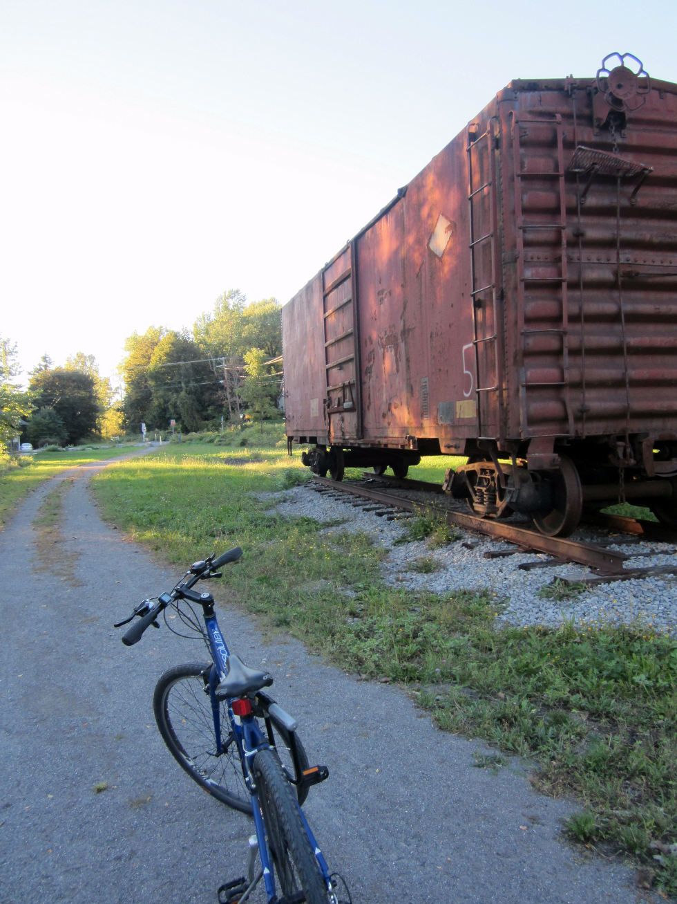
Remnants of the track yard and station are very evident here. This area looks to have recently embraced its past with a train car display, benches, historical signs, and a new building.
![- [PHOTO: Ryan Green]](https://senseofplace.dev/content/images/photos/rgbike-rochester-genesee-valley-greenway-lehigh-valley-trail-LV100.jpg)
![- [PHOTO: Ryan Green]](https://senseofplace.dev/content/images/photos/rgbike-rochester-genesee-valley-greenway-lehigh-valley-trail-LV97.jpg)
Maybe we'll save a trip to New York City for another time
![- [PHOTO: Ryan Green]](https://senseofplace.dev/content/images/photos/rgbike-rochester-genesee-valley-greenway-lehigh-valley-trail-LV98.jpg)
This sharp point was where the North Branch diverged from the main line.
![- [PHOTO: Ryan Green]](https://senseofplace.dev/content/images/photos/rgbike-rochester-genesee-valley-greenway-lehigh-valley-trail-LV99.jpg)
From here, it's about another 5 miles to the town of Mendon, and less than 10 miles to basically the end of the trail near victor. The trail connects to the Auburn Trail

before Victor.
We take the sharp turn and cross back over Plains Road to begin our journey back north. Sorry folks, we must leave our horses behind, now.
![- [PHOTO: Ryan Green]](https://senseofplace.dev/content/images/photos/rgbike-rochester-genesee-valley-greenway-lehigh-valley-trail-LV102.jpg)
![- [PHOTO: Ryan Green]](https://senseofplace.dev/content/images/photos/rgbike-rochester-genesee-valley-greenway-lehigh-valley-trail-LV103.jpg)
![- [PHOTO: Ryan Green]](https://senseofplace.dev/content/images/photos/rgbike-rochester-genesee-valley-greenway-lehigh-valley-trail-LV104.jpg)
![- [PHOTO: Ryan Green]](https://senseofplace.dev/content/images/photos/rgbike-rochester-genesee-valley-greenway-lehigh-valley-trail-LV105.jpg)
![- [PHOTO: Ryan Green]](https://senseofplace.dev/content/images/photos/rgbike-rochester-genesee-valley-greenway-lehigh-valley-trail-LV106.jpg)
Why, hello, you handsome chap!
Some views of the typical conditions of the North Branch of the Lehigh Valley Trail:
![- [PHOTO: Ryan Green]](https://senseofplace.dev/content/images/photos/rgbike-rochester-genesee-valley-greenway-lehigh-valley-trail-LV107.jpg)
We cross Rush Mendon Road at 24.4 miles, Pinnacle Road at 25.3 miles, Jeffords Road at 25.8 miles, E Henrietta Road at 27.0 miles, and under Erie Station Road at 28.1 miles.
![- [PHOTO: Ryan Green]](https://senseofplace.dev/content/images/photos/rgbike-rochester-genesee-valley-greenway-lehigh-valley-trail-LV108.jpg)
![- [PHOTO: Ryan Green]](https://senseofplace.dev/content/images/photos/rgbike-rochester-genesee-valley-greenway-lehigh-valley-trail-LV109.jpg)
![- [PHOTO: Ryan Green]](https://senseofplace.dev/content/images/photos/rgbike-rochester-genesee-valley-greenway-lehigh-valley-trail-LV110.jpg)
![- [PHOTO: Ryan Green]](https://senseofplace.dev/content/images/photos/rgbike-rochester-genesee-valley-greenway-lehigh-valley-trail-LV111.jpg)
Not the most reassuring sign to read, and probably not the best place to put benches.
![- [PHOTO: Ryan Green]](https://senseofplace.dev/content/images/photos/rgbike-rochester-genesee-valley-greenway-lehigh-valley-trail-LV112.jpg)
![- [PHOTO: Ryan Green]](https://senseofplace.dev/content/images/photos/rgbike-rochester-genesee-valley-greenway-lehigh-valley-trail-LV113.jpg)
The sun is setting! Will we make it back by nightfall? (The answer will be no- due to my poor planning and love to sleep in way too late.)
![- [PHOTO: Ryan Green]](https://senseofplace.dev/content/images/photos/rgbike-rochester-genesee-valley-greenway-lehigh-valley-trail-LV114.jpg)
At 28.7 miles, we cross back under the Thruway, and bear right, up a hill into a large field.
![- [PHOTO: Ryan Green]](https://senseofplace.dev/content/images/photos/rgbike-rochester-genesee-valley-greenway-lehigh-valley-trail-LV115.jpg)
![- [PHOTO: Ryan Green]](https://senseofplace.dev/content/images/photos/rgbike-rochester-genesee-valley-greenway-lehigh-valley-trail-LV116.jpg)
![- [PHOTO: Ryan Green]](https://senseofplace.dev/content/images/photos/rgbike-rochester-genesee-valley-greenway-lehigh-valley-trail-LV117.jpg)
We keep going until we see a street with many cul-de-sacs in a suburban neighborhood (Nevins Road) at 29.1 miles.
![- [PHOTO: Ryan Green]](https://senseofplace.dev/content/images/photos/rgbike-rochester-genesee-valley-greenway-lehigh-valley-trail-LV118.jpg)
![- [PHOTO: Ryan Green]](https://senseofplace.dev/content/images/photos/rgbike-rochester-genesee-valley-greenway-lehigh-valley-trail-LV119.jpg)
We ride straight, on the road, cross Lehigh Station Road at 29.5 miles, and see another section of the trail, which passes along the back yards of some houses.
![- [PHOTO: Ryan Green]](https://senseofplace.dev/content/images/photos/rgbike-rochester-genesee-valley-greenway-lehigh-valley-trail-LV120.jpg)
We reach Veterans Memorial park and ride through to its northwest corner.
![- [PHOTO: Ryan Green]](https://senseofplace.dev/content/images/photos/rgbike-rochester-genesee-valley-greenway-lehigh-valley-trail-LV121.jpg)
At the edge of the park, we see a sign explaining the route we should take to connect with the final portion of the trail. I diverge a little from this route. Instead of taking West Henrietta farther up and taking a left on Jefferson, I turn on Bailey then ride by RIT. From what I can tell, the route I took was the less stressful one.
![- [PHOTO: Ryan Green]](https://senseofplace.dev/content/images/photos/rgbike-rochester-genesee-valley-greenway-lehigh-valley-trail-LV122.jpg)
We reach Calkins Road at 30.3 miles, and follow the sign, crossing it and taking it left. This part will be the longest on-road portion.
![- [PHOTO: Ryan Green]](https://senseofplace.dev/content/images/photos/rgbike-rochester-genesee-valley-greenway-lehigh-valley-trail-LV123.jpg)
The sidewalk ends on Calkins, and we have no choice but to ride on the road.
We cross under I-390 and then reach W. Henrietta road at 31.2 miles. We cross it, take a right on the sidewalk as the trail signs suggest, then cross Bailey Rd, and take a left on it.
![- [PHOTO: Ryan Green]](https://senseofplace.dev/content/images/photos/rgbike-rochester-genesee-valley-greenway-lehigh-valley-trail-LV124.jpg)
We then reach John Street at about 32.6 miles, we cross it, and take a right on the path. We have a nice 1.5 mile straight downhill to enjoy. Wow, look, the sun magically came back up!
![- [PHOTO: Ryan Green]](https://senseofplace.dev/content/images/photos/rgbike-rochester-genesee-valley-greenway-lehigh-valley-trail-LV125.jpg)
We pass by the RIT Observatory as we ride along the edge of the campus.
![- [PHOTO: Ryan Green]](https://senseofplace.dev/content/images/photos/rgbike-rochester-genesee-valley-greenway-lehigh-valley-trail-LV126.jpg)
![- [PHOTO: Ryan Green]](https://senseofplace.dev/content/images/photos/rgbike-rochester-genesee-valley-greenway-lehigh-valley-trail-LV127.jpg)
We cross Jefferson road, then railroad tracks, and over a creek.
![- [PHOTO: Ryan Green]](https://senseofplace.dev/content/images/photos/rgbike-rochester-genesee-valley-greenway-lehigh-valley-trail-LV128.jpg)
Then take a left back on to the final portion of the trail at around 34.3 miles.
![- [PHOTO: Ryan Green]](https://senseofplace.dev/content/images/photos/rgbike-rochester-genesee-valley-greenway-lehigh-valley-trail-LV129.jpg)
![- [PHOTO: Ryan Green]](https://senseofplace.dev/content/images/photos/rgbike-rochester-genesee-valley-greenway-lehigh-valley-trail-LV130.jpg)
We cross Crittenden Road at 35.1 miles.
![- [PHOTO: Ryan Green]](https://senseofplace.dev/content/images/photos/rgbike-rochester-genesee-valley-greenway-lehigh-valley-trail-LV131.jpg)
![- [PHOTO: Ryan Green]](https://senseofplace.dev/content/images/photos/rgbike-rochester-genesee-valley-greenway-lehigh-valley-trail-LV132.jpg)
![- [PHOTO: Ryan Green]](https://senseofplace.dev/content/images/photos/rgbike-rochester-genesee-valley-greenway-lehigh-valley-trail-LV133.jpg)
![- [PHOTO: Ryan Green]](https://senseofplace.dev/content/images/photos/rgbike-rochester-genesee-valley-greenway-lehigh-valley-trail-LV134.jpg)
And then cross E River Road at 35.9 miles. Unfortunately, we must stop firing our guns now.
![- [PHOTO: Ryan Green]](https://senseofplace.dev/content/images/photos/rgbike-rochester-genesee-valley-greenway-lehigh-valley-trail-LV135.jpg)
![- [PHOTO: Ryan Green]](https://senseofplace.dev/content/images/photos/rgbike-rochester-genesee-valley-greenway-lehigh-valley-trail-LV136.jpg)
![- [PHOTO: Ryan Green]](https://senseofplace.dev/content/images/photos/rgbike-rochester-genesee-valley-greenway-lehigh-valley-trail-LV137.jpg)
We cross over I-390 and the Erie Canal via the old Railroad bridges at 36.2 miles and end up back on the Canal Trail. If we continue straight, we can take a shortcut through the parking lots and campus of the U of R. But, we take a left, West on the Canal Trail very briefly, then north on the Riverway Trail.
![- [PHOTO: Ryan Green]](https://senseofplace.dev/content/images/photos/rgbike-rochester-genesee-valley-greenway-lehigh-valley-trail-LV138.jpg)
![- [PHOTO: Ryan Green]](https://senseofplace.dev/content/images/photos/rgbike-rochester-genesee-valley-greenway-lehigh-valley-trail-LV139.jpg)
![- [PHOTO: Ryan Green]](https://senseofplace.dev/content/images/photos/rgbike-rochester-genesee-valley-greenway-lehigh-valley-trail-LV140.jpg)
![- [PHOTO: Ryan Green]](https://senseofplace.dev/content/images/photos/rgbike-rochester-genesee-valley-greenway-lehigh-valley-trail-LV141.jpg)
![- [PHOTO: Ryan Green]](https://senseofplace.dev/content/images/photos/rgbike-rochester-genesee-valley-greenway-lehigh-valley-trail-LV142.jpg)
![- [PHOTO: Ryan Green]](https://senseofplace.dev/content/images/photos/rgbike-rochester-genesee-valley-greenway-lehigh-valley-trail-LV143.jpg)
We cross over the Erie Lackawanna Railroad Bridge on the north side of the U of R at 36.2 miles. The EL and LVRR ran alongside each other at what is now the University of Rochester. The EL crossed the river here to continue downtown on the West bank, while the LVRR continued on the East bank.
![- [PHOTO: Ryan Green]](https://senseofplace.dev/content/images/photos/rgbike-rochester-genesee-valley-greenway-lehigh-valley-trail-LV144.jpg)
The LVRR bridge from the EL Railroad Bridge.
![- [PHOTO: Ryan Green]](https://senseofplace.dev/content/images/photos/rgbike-rochester-genesee-valley-greenway-lehigh-valley-trail-LV145.jpg)
![- [PHOTO: Ryan Green]](https://senseofplace.dev/content/images/photos/rgbike-rochester-genesee-valley-greenway-lehigh-valley-trail-LV146.jpg)
We are treated with a view of an egret and the skyline on a Fall day.
![- [PHOTO: Ryan Green]](https://senseofplace.dev/content/images/photos/rgbike-rochester-genesee-valley-greenway-lehigh-valley-trail-LV147.jpg)
![- [PHOTO: Ryan Green]](https://senseofplace.dev/content/images/photos/rgbike-rochester-genesee-valley-greenway-lehigh-valley-trail-LV148.jpg)
We have made it! When we reach the entrance at Court Street, we have completed just shy of 40 miles (39.6)!

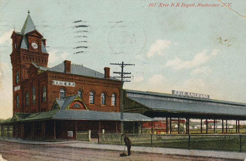
This spot was where the Erie Railroad station once stood. We take a short stroll on Court Street across the river.
![- [PHOTO: Ryan Green]](https://senseofplace.dev/content/images/photos/rgbike-rochester-genesee-valley-greenway-lehigh-valley-trail-LV149.jpg)
![- [PHOTO: Ryan Green]](https://senseofplace.dev/content/images/photos/rgbike-rochester-genesee-valley-greenway-lehigh-valley-trail-LV150.jpg)
And now one last, perhaps more meaningful, look at the Lehigh Valley Station building. The heyday of the private passenger railroads that helped to shape our cities and history is now long gone (for now), but we can still enjoy their legacy in other ways.
I'll admit, I wasn't too eager about this route, but I was pleasantly surprised by how nice and serene it was. Aside from the group doing the movie shoot, I saw about 6 people on the entire trail.
Stay tuned for the final part of this series!
* * *
About Ryan Green:
Ryan Green is from Albany, NY. He went to undergrad for Chemical engineering and Electrical engineering at SUNY Buffalo, and while in Buffalo, caught the industrial history/architecture/urban exploration bug. He volunteered at the Buffalo Central Terminal a few times. He is now attending University of Rochester for a Masters in Materials Science and is a member of the UofR Urban Exploration Club.


